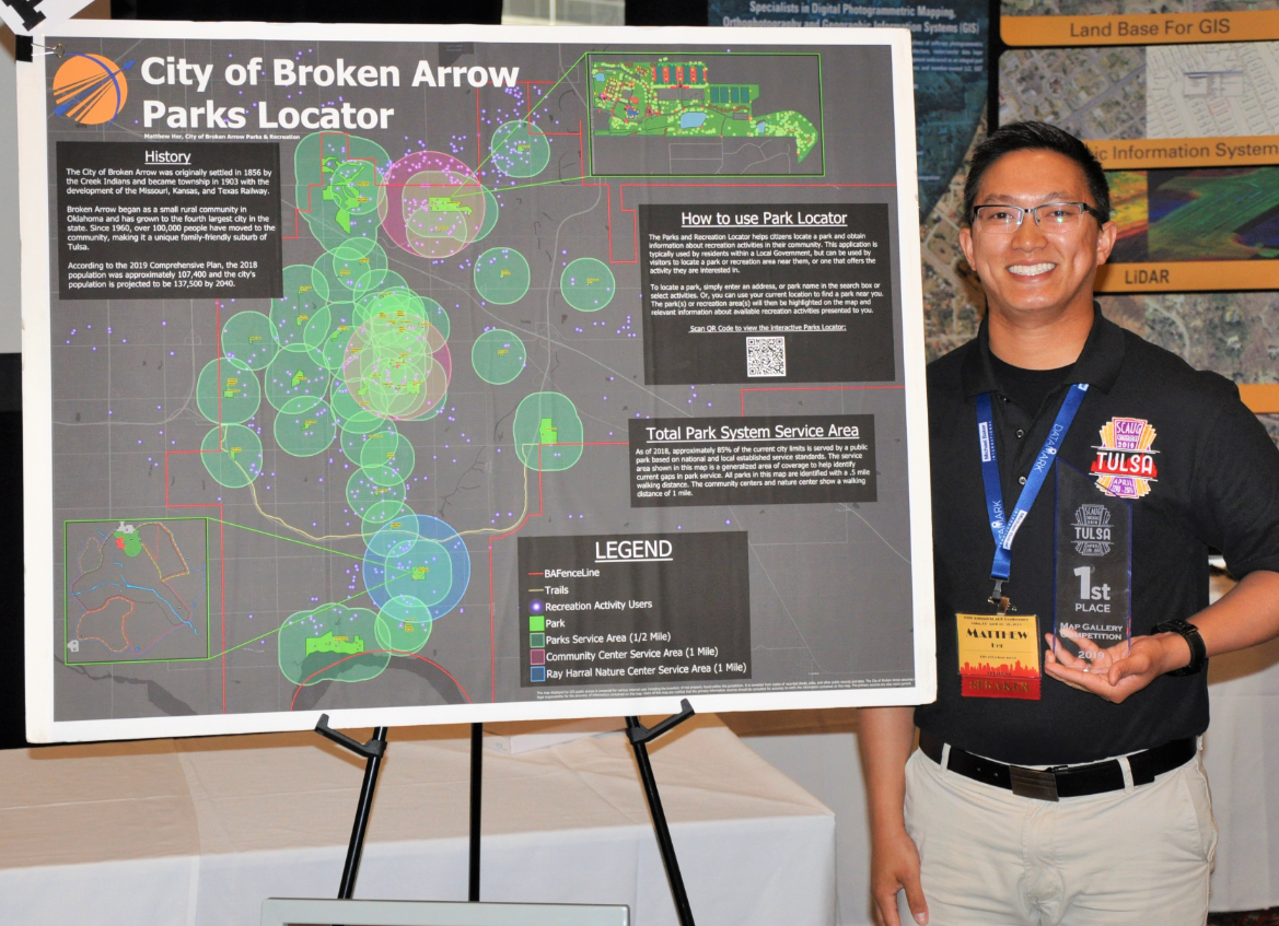
The City of Broken Arrow Wins Award for Parks Locator Map
After a successful implementation of GreenCityGIS for the City of Broken Arrow, Oklahoma, Matthew Her, a Recreation Technician with the city, reached out to Geographic Technologies Group to express his excitement in the city’s Parks and Recreation Locator map winning first place in a Map Gallery Competition.
Matthew submitted the map for consideration while attending the SCAUG (South Central Arc User Group) Regional Conference, which was held in the City of Tulsa, OK in April. The City of Broken Arrow Parks Locator won first Place in the Best Map Gallery — voted by SCAUG conference attendees — because of its overall visual appeal and use of data. Conference attendees loved the way they could scan the QR code on the map and interact with the Parks Locator Tool, making the map the most unique at the event.
City of Broken Arrow History
The City of Broken Arrow began as a rural community on the outskirts of Tulsa but has since grown to be the fourth largest city in Oklahoma. The City was originally settled in 1856 by the Creek Indians. It became an official township in 1903 when the Missouri, Kansas, and Texas Railway helped bring settlers into the area. Since 1960, over 100,000 people have moved to the area, making it a unique and family-friendly suburb of Tulsa. In 2018, the population was approximately 107,400 citizens.
Total Park System Service Area
As of 2018, approximately 85% of the current Broken Arrow city limits are served by a public park based on national and local established service standards. The service area shown on the award-winning map is a generalized area of coverage to help the local government identify current gaps in park service. All parks shown on the map are identified with a .5-mile walking distance. The community centers and nature center display a walking distance of 1 mile. The one exclusion from the map was undeveloped and new parks under construction.
About the Application
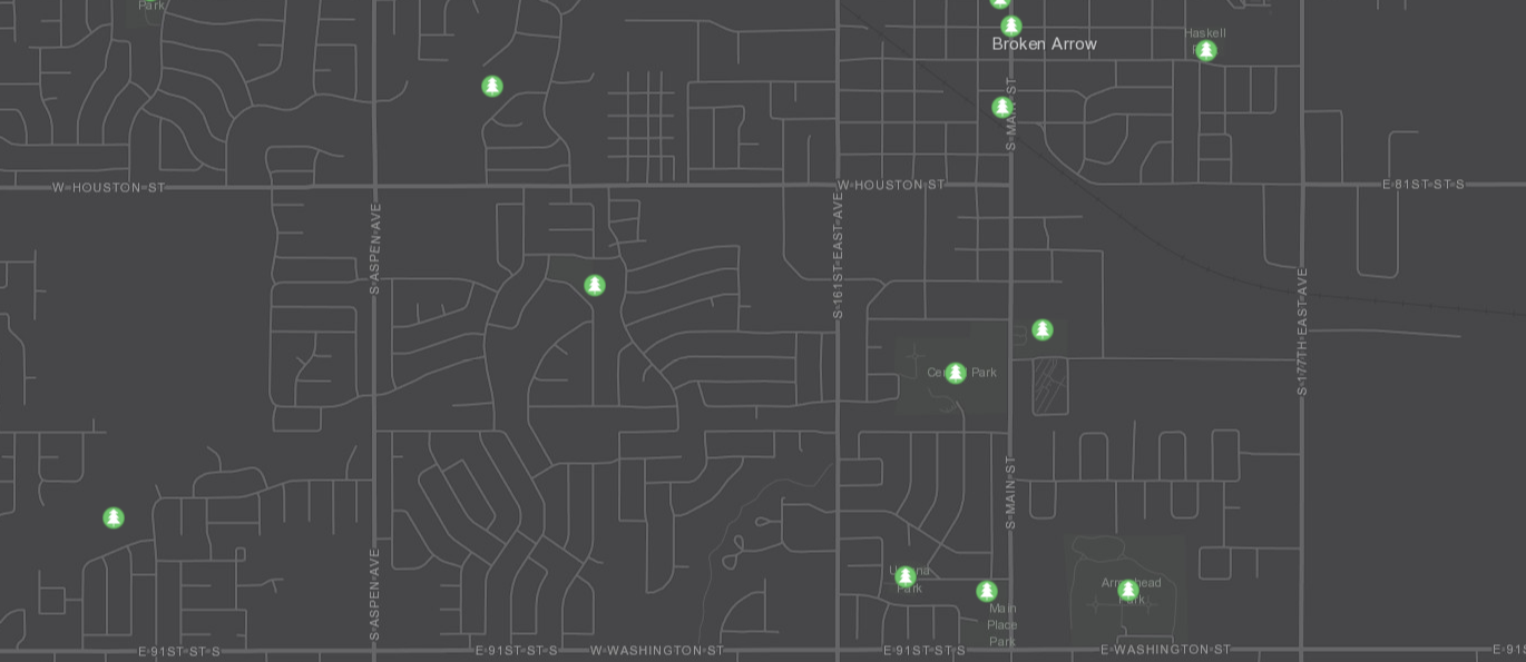
The Parks and Recreation Locator application helps citizens locate a park and obtain information about available recreation activities in their community from any web browser. This application is typically used by residents within a local government but can be used by visitors to locate a park or recreation area near them, or one that offers an activity in which they are interested.
Matthew Her states, “The public’s reaction to the Parks Locator Tool has been very positive. Many responses expressed how the activities filtering feature is cool, and users like that they can identify a specific park that meets their needs. Another response was the application’s ease of use. Then there were some responses that gave input on improvements and future add-ons.”
The Park Locator is one tool of the GreenCityGIS Suite. GreenCityGIS is the most powerful combination of GIS tools for Parks and Recreation Departments on the market. GreenCityGIS allows staff to view and manage all assets, programs, and customers. The public is given a number of tools to view and understand the Parks and Recreation offerings for their area.
For more information about this tool and the full suite of Parks and Recreation tools offered with GreenCityGIS and Geographic Technologies Group, please contact James Kelt at 888.757.4222 or by email to jkelt@geotg.com. You can also learn more about GreenCityGIS services by visiting GreenCityGIS.com.