SafeCityGIS: GIS Technology Simplifies E911 Dispatch and Emergency Response
Historical data is at their fingertips for data-driven decision making, and the complex is now well-prepared for both emergency and non-emergency events.

Historical data is at their fingertips for data-driven decision making, and the complex is now well-prepared for both emergency and non-emergency events.
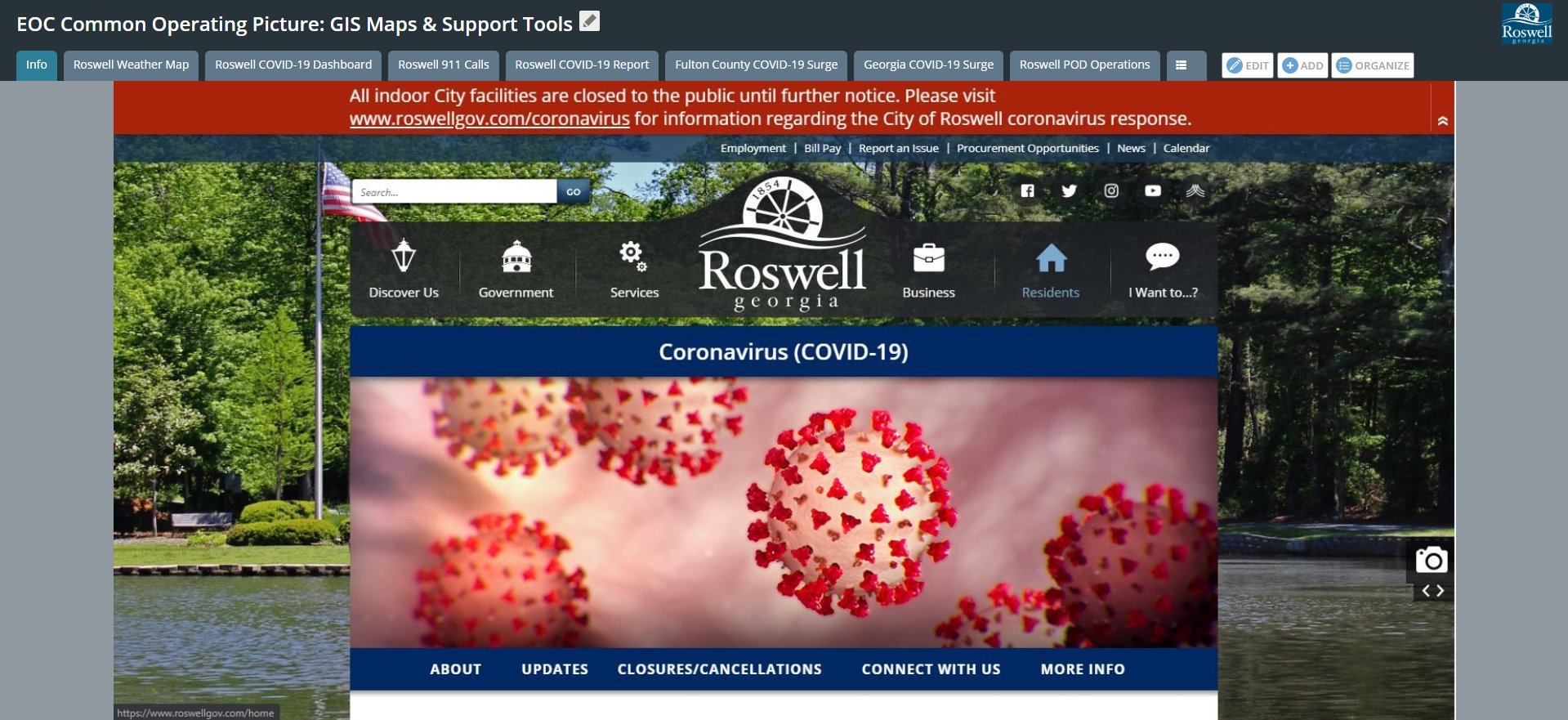
Since the implementation of advanced GIS applications and tools, the City of Roswell has gained an increased awareness in COVID-19 response efforts. They have the ability to evaluate patterns and trends associated with historical and current call volumes and are able to reference a comprehensive environment for visualization, response, and analysis.
To assist with this evaluation and work-plan evaluation, Gwinnett County contracted with Geographic Technologies Group (GTG) to perform an addressing assessment and recommendations document.
Westmoreland County contracted the GIS experts at Geographic Technologies Group (GTG) to provide a solution beginning in 2016. Upon review of their antiquated 911 programs, GTG proposed a 3-step approach.
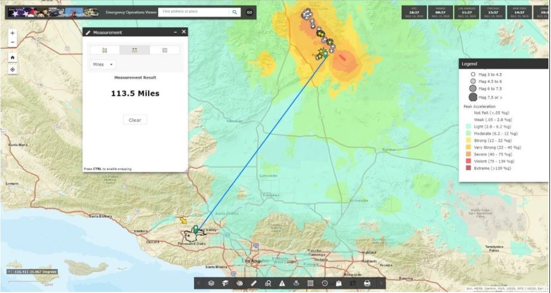
When the July 2019 quakes occurred, the EOC was prepared with their Emergency Operations Viewer. They uploaded quake data into the program to visualize the location and magnitude of the quake and how it would affect their residents.
This system was to be utilized to its full extent as a foundation for decision-making and strategic planning regarding the development and management of the daily operations of the City’s EOC.
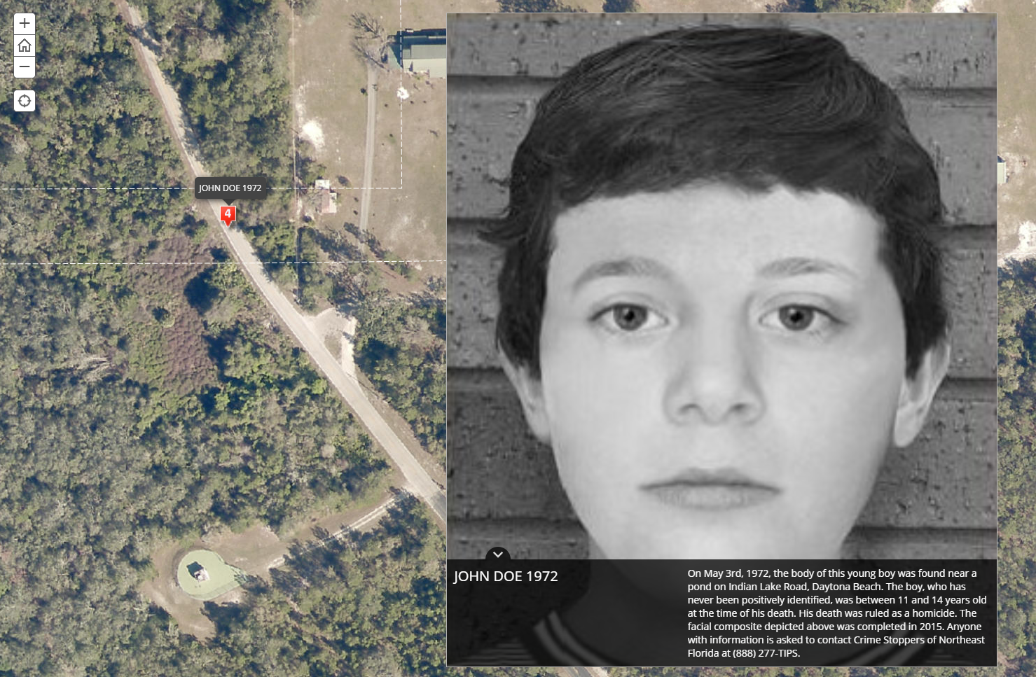
In 2018, their Sheriff’s Office Cold Case Unit partnered with Crime Stoppers of Northeast Florida and enlisted the expertise of Geographic Technologies Group (GTG) to work on the project. Their goal was to create a public-facing application with the potential to solve cold cases dating back to 1967.
West Hollywood’s EOC wanted to do more than just map basic emergency response data – they wanted to visualize key assets and events throughout the city, track activities and assets in real-time, manage all key elements of events (emergency and non-emergency) through a common operational picture, and be able to quickly and effectively report information and activities to the executive team.
Moore officials decided to replace their CAD and RMS software and required a robust Esri-based mapping component for their Dispatch and Crime Analysis units. The project involved the conversion of several years of data; the installation and implementation of the software; and administrative and end-user training and on-going support.
The Missouri City Police Department welcomes the integration of advanced crime analysis tools for the city’s geographic information system (GIS) courtesy of a strategic planning initiative set in motion by the city back in 2016.