
These Crimes May Be Cold, But Emotions Are Not: Discover a Map That Highlights all Cold Cases in Volusia County, Florida
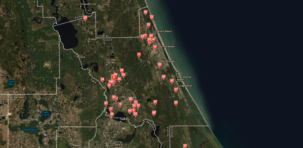
The Volusia County technology team is proactive and leading edge with a significant investment in Geographic Information Systems (GIS) and the Esri suite of programs. During the County’s recent GIS Strategic Planning Process each department was interviewed. Of particular interest was the discussion of the cold cases managed by the Sheriff’s Office and how GIS might be able to assist in educating the community and possibly identifying new leads. In 2018, their Sheriff’s Office Cold Case Unit partnered with Crime Stoppers of Northeast Florida and enlisted the expertise of Geographic Technologies Group (GTG) to work on the project. Their goal was to create a public-facing application with the potential to solve cold cases dating back to 1967.
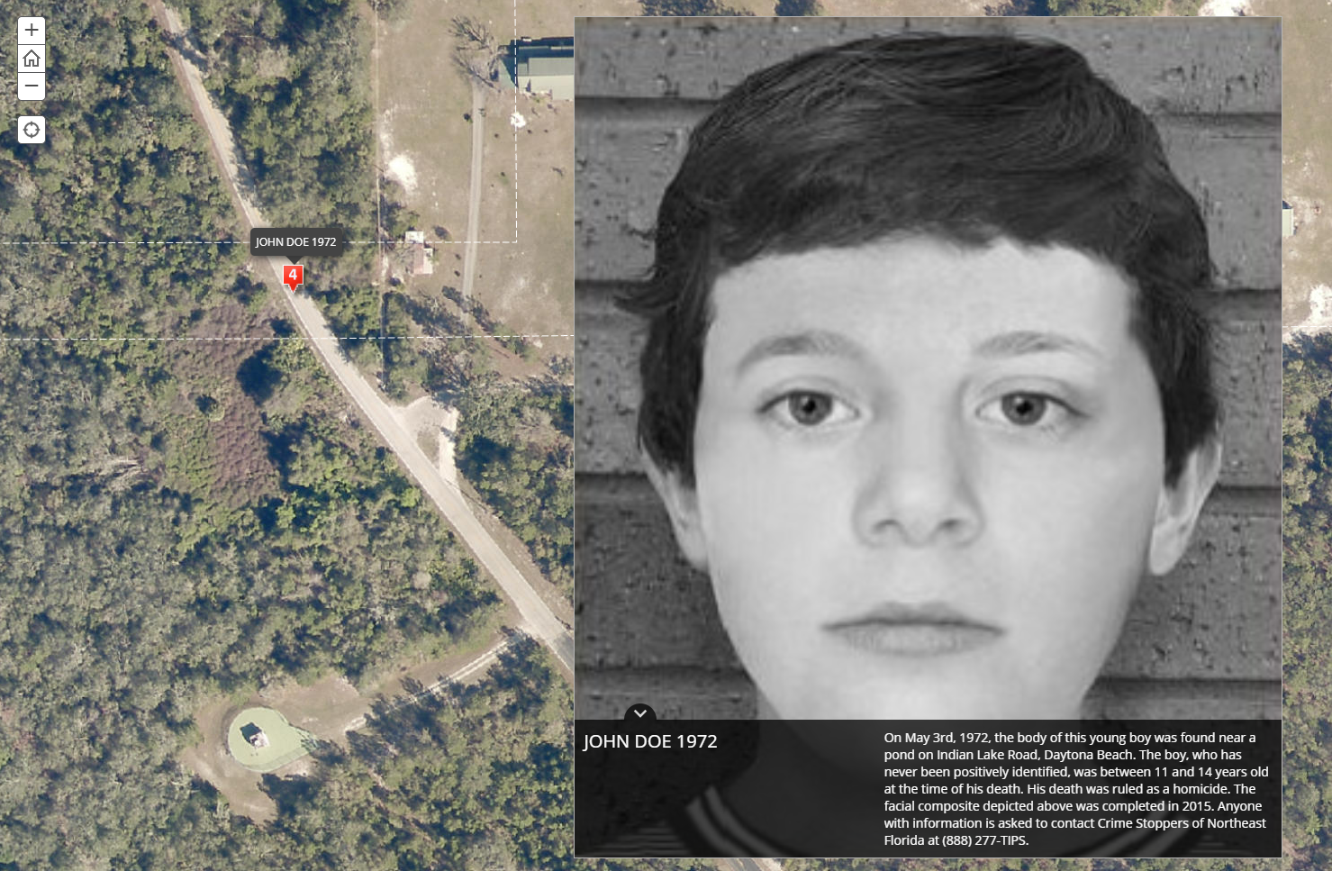
Their application came to fruition in the form of an online GIS-based Story map. The first case listed on the map features Otto Goodman, a gas station attendant who was shot during an armed robbery and died because of the injury. A following case introduces viewers to a young John Doe, whose body was found near a pond in May 1972 and appears to be between the ages of 11 and 14. A facial composite was generated in 2015, but there are still no leads regarding his identity. Then there’s 15-year-old Laralee Spear, who never returned after getting off her school bus in 1994. Her body was found in a secluded area near where she lived, but no one has provided information leading to a conviction in her murder.
While these cases are hard to stomach, the Esri-powered Story Map created by GTG provides a vital public connection and may yield new leads in these cold cases. Public education and awareness is a key element in solving crimes, both recent and in the distant past. The goal of the Story Map is to communicate the details of these cases to the community with the hope that someone, somewhere, will be able to provide critical information.
In the initial stages of the project, GTG focused on compiling the data needed to build out a Cold Case Map. Powered by Esri’s Story Map program from ArcGIS, GTG and Sheriff Department staff combined the details of each unsolved case with satellite imagery. The map features a bottom scrolling menu bar with each victim listed in chronological order. Clicking the image associated with a victim enlarges the photo and brings up details about the case. In addition, the background map zooms into a red marker placed on a satellite overview to pinpoint the location the body was discovered. The write-up on each case includes a request for anyone with information to contact Crime Stoppers of Northeast Florida.
County Sheriff Deputies hope that this interactive tool will increase public awareness and lead to new information that may bring resolution for the families who are still mourning the loss of their loved ones and living without answers, sometimes even decades after the crime. These cases are obviously heartbreaking for those who knew the victims, but they are also difficult for the officers tasked with closing them. Unsolved crimes impact entire communities, and the SafeCityGIS suite was created to offer hope with innovative software solutions.
To learn more about Story Maps and the full suite of public safety tools available from Geographic Technologies Group, visit SafeCityGIS.com, email info@geotg.com, or give us a call at 888.757.4222.


