

How GIS Data Improvements Lead to a Successful Next Generation 911 Deployment
Public Safety mapping systems are only as good as the data within them. The use of outdated 911 mapping products makes it difficult to maintain an accurate and complete address database. For this reason, Westmoreland County, Virginia recently replaced its antiquated 911 mapping product with a copy of a modern 911 mapping software suite. This has given Westmoreland County 911 the ability to view calls for service and a variety of other critical data sets. The county recognized that discrepancies in their address databases could lead to integrity issues with the Master Street Address Guide (MSAG), Automatic Location Information (ALI) and, ultimately, 911 dispatch. Discrepancies between the geographic information systems (GIS), the MSAG, and the ALI data can lead to a delayed or improper response and dispatch routing problems.
Westmoreland County contracted the GIS experts at Geographic Technologies Group (GTG) to provide a solution beginning in 2016. Upon review of their antiquated 911 programs, GTG proposed a 3-step approach. First, they would evaluate existing GIS layers to determine the rate of compliance to the NENA standard. Second, the team would work on data editing and an improvement process for required layers. And to close out the project, GTG’s team would deliver updated required layers, and assist in the development of a maintenance process for the data.
Ethan Credle, Project Manager of GTG, stated, “The key component which led to this projects success was clear and open communication between all parties. The contributions of Westmoreland personnel’s local knowledge, VITA’s complete understanding of the inner workings of Next Generation 911, and GTG’s knowledge and experience working with emergency response data and departments made for a great team and successful project. These types of projects are of the upmost importance as they lead to improved emergency response times, resulting in more lives saved.”
To begin the process, GTG worked closely with county officials to understand their immediate and long-term addressing needs. GTG’s analysts then began developing an address point data model. The importance of this unique address data model was that it needed to be compliant with the National Emergency Number Association (NENA), US Postal Service, Federal Geographic Data Committee (FGDC) and Urban and Regional Information Systems Association (URISA) national addressing standards.
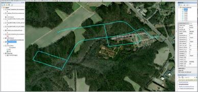
Geographic Technologies Group utilized a combination of numerous common technologies to create a unique and powerful field data collection workflow. GTG performed comparative analysis between datasets and marking addresses when discrepancies were identified. Then GTG conducted onsite address verifications which led to addresses being added, updated, or removed as necessary. The onsite address verifications were conducted using Esri’s Collector for ArcGIS application. This application was downloaded on iPads and deployed to accomplish each of the components required for the verifications. GTG also set up a live application in which data changes automatically updated within the database, allowing project managers to review once back in the office. Next, GTG reviewed all data changes and centered all address points on corresponding structures, finalizing the analysis and concluding step one.
Steps 2 and 3 were kicked off in 2018. Now that significant improvements had been made to the addresses based on ground truthing, it was time to identify inconsistencies and discrepancies between centerlines and the ALI database. GTG performed a series of checks to clean up the inconsistencies, then leveraged VITA’s (Virginia Information Technology Association) published ArcGIS tools to determine discrepancies between GIS and ALI databases. After working through the flagged issues, Westmoreland’s data was improved to the point which met the required NENA standard.
Once the centerline and address data were up to par, GTG began pushing the data into the NENA required schema. This was a crucial part of the project which required a high level of communication between Westmoreland, VITA, and GTG personnel. The project was concluded with an onsite visit to Westmoreland where project steps completed were recapped, maintenance workflows were discussed, and next steps to Westmoreland’s Next Generation 911 deployment were identified.
As Westmoreland moves forward with Next Generation 911 program implementation, their goal is to see a dramatic increase in efficiencies and response times. The more reliable address data will assist first responders with locating incidents in a timely manner to ensure a safer community.
For more information about SafeCityGIS and the entire suite of public safety software solutions, visit SafeCityGIS.com or, you can contact us for a free demo!


