

Moore, OK & SafeCityGIS
The City of Moore, Oklahoma lies just nine miles south of Oklahoma City and was incorporate in 1893, seven years after three railways laid tracks through the area. Through 1950, Moore remained a small town with a population of less than 1,000 people. But in the decade between 1960 and 1970, that population quickly grew to nearly 19,000 and became one of Oklahoma’s fastest growing cities. As of the 2010 census, the city boasts a population of 55,081. Moore has a strong focus on community enrichment and amenities and features eight city parks, a community center, library, community pool, and several golf courses.
While the city does its best to provide healthy lives for its citizens, it must be ever aware of its location — in the middle of an area often referred to as “tornado alley.” In fact, it is in the worst area of Tornado Alley with more than 15 reported tornadoes per 1,000 square miles, and it is normal for the state of Oklahoma to see around 62 tornadoes in just one year. As the city works to increase safety measures for their citizens, they turned to Geographic Technologies Group (GTG) to elevate their management systems with GIS.
In April of 2018, Professional and Technical Software (PTS) Solutions and GTG responded to The City of Moore’s request for proposal. Moore officials decided to replace their CAD and RMS software and required a robust Esri-based mapping component for their Dispatch and Crime Analysis units. At the core of their requirements was a solution with user-friendly systems that met the functionality requirements of their current processes and existing software in use by the city.
The project involved the conversion of several years of data; the installation and implementation of the software; and administrative and end-user training and on-going support. PTS took the lead on the project to provide public safety software and their related training and support, while GTG provided Vantage Points solutions for mapping and Automated Vehicle Locator (AVL) technology. The City of Moore accepted the proposal because they felt it was the best submittal for overall functionality, cost, and leveraged their existing ArcGIS Enterprise licensing from ESRI.
As PTS tackled their portion of the contract, GTG set out to fulfill the customization and implementation of three software programs:
- Vantage Points Dispatch
- Vantage Points AVL
- Vantage Points Crimes Mapping
James Kelt, GTG Senior Solutions Provider, explains, “We have developed Vantage Points Dispatch with the ability to interface with any Computer Aided Dispatch vendor to display calls for service, 911 calls, Automatic Vehicle Locations (AVL), ArcGIS on-line services, WMS weather feeds, mission critical hot-linked features, and internal GIS map services.”
VANTAGE POINTS DISPATCH
Vantage Points Dispatch provides City of Moore dispatchers with a robust and easy-to-use GIS application that leverages the best of the Esri GIS toolset to ensure that dispatchers have the most user friendly and powerful tools available. Vantage Points GIS is a concurrent licensed GIS application and allows The City of Moore, OK to deploy the software on any workstation and provide a common operational picture of real-world data as events occur.
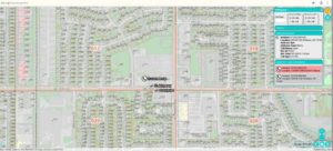
This GIS-centric dispatch program creates a seamless sharing of data between all users within the Public Safety Departments, while providing a host of critical data to dispatchers. Customized queries give dispatchers the ability to search any location by attribute and geography in a single search. Reporting capabilities along with a dashboard display show trends in calls for service that brings real world information to life.
VANTAGE POINTS AVL
With Automated Vehicle Location (AVL), you can track on a map the exact location of public safety vehicles or any GPS-enabled device in real-time. GTG implemented this powerful tool for The City of Moore to manage and dispatch emergency vehicles, fleets of trucks and specialty equipment during a natural or man-made disaster. AVL works together with other public safety software tools to help dispatchers send the closest unit to a call for service, decreasing response time and potentially saving lives. Dispatcher insight into the location of incidents and resources provides greater efficiency in assigning the right resource to the right incident to reduce response times. City of Moore public safety officials knew that being able to quickly find dispatched and on-call units and equipment is not only efficient, it can also mean the difference between life and death for citizens.
With AVL, users able to group units by type, classification, or capability with unique custom ions for each. Public safety teams can geo-locate any GPS-enabled device in real time and see if police are patrolling the correct areas. It also assists directing offices in hot pursuits and can playback events in sequence. The data within the Vantage Points AVL system help directors and executives assess tactical situations with information about committed and available units, and also allows the retrieval of historical data for workload analysis, investigations, and in response to citizen concerns.
VANTAGE POINTS CRIME MAPPING
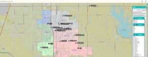
Accurate crime data is an indispensable tool for law enforcement agencies. It provides the basis for predictive analysis, resource allocation, statistics reporting, and a measure of accountability. GTG’s Crime Analytics software allows The City of Moore to dynamically visualize their records management database and perform statistical, tabular, and spatial analytics. Vantage Points Crime Mapping software is an Esri-based technology that integrates data from any Records Management System and Computer Aided Dispatch database. Querying data is fast and easy with configurable searches based on criteria such as geography, incident type, date and time ranges, responding officer, suspects and more.
Among the benefits The City of Moore is now experiencing are easier to read maps, higher location accuracy for dispatch, and more efficient operations with better tools for analysis, search, and tracking. Tammy Koehn, Communications Supervisor for the Moore Police Department explains, “There are so many benefits that we have been able to experience with this new software. Our map districts are laid out much nicer and are easy to see; the address search capabilities are outstanding. The location accuracy with latitude and longitude are much more precise, and the markup and measurement tools will be a great benefit. We are still getting used to all the tools, but I can definitely see great benefits with this system.”
With the public safety programs provided by PTS, and the Vantage Points Dispatch, AVL, and Crime Mapping solutions from GTG, The City of Moore experiences increased efficiencies, faster emergency response times, more accurate dispatches, and now promote comprehensive data-driven decision making. They are able to provide better and more valuable information to both executives and citizens for transparency and education.
Many departments at the City of Moore use GIS. The Community Development Department is the primary user, and implements GIS for planning, zoning, building and commercial permits, code enforcement, and flood plain administration. The water and sewer system is managed with GIS, and the Economic Development team uses GIS to provide data to businesses and industries interested in relocating or building in Moore. The city plans to continue the widespread use of GIS across all departments to increase efficiencies, especially within parks, public works, and utility billing. With this public safety implementation, they are well on their way to achieving true enterprise GIS.
“I have been in this business for 23 years and I have NEVER worked with a more helpful vendor! GTG and James Kelt have been absolutely phenomenal when it comes to training, answering questions, and assisting us with whatever we need. I would — without hesitation — recommend this company to anyone. Hands down the best vendor I have ever worked with!” – Tammy Koehn, Communications Supervisor for the Moore Police Department
For more information about Public Safety and Emergency Management Systems from Geographic Technologies Group, please visit SafeCityGIS.com or call our team at 888.757.4222.


