
The small, family-oriented Town of Windsor, California is located north of San Francisco in the Sonoma Valley with a population of just over 27,500. It is home to 20 parks across 7.3 square miles and offers recreational activities for all ages and abilities. The Town has received a number of awards and recognitions – including best land use design, and healthy community – and endeavors to continuously find innovative ways to improve the lives of its citizens.
Geographic Technologies Group (GTG) has worked with Town officials for over eight years providing GIS services and solutions. The adoption of Esri’s ArcGIS Online in 2012 kicked their GIS programs into high gear and was quickly followed by the creation of a GIS Strategic Plan. GTG has since primarily assisted the Public Works and Parks and Recreation Departments with extensive application development and implementation. When the Parks and Recreation Department concluded their Master Plan update in 2016, they were GIS-enabled with a full suite of software from GTG, GreenCityGIS.
Specialized for Parks and Recreation Departments, GreenCityGIS offers the latest GIS technology for efficient park management in two simple steps: park asset inventory and software solutions. There are five primary, easy-to-use software options within GreenCityGIS, together offering one premium solution. This new GIS technology seamlessly turns park and recreation data into meaningful decision support information for the Town’s Parks staff to utilize.
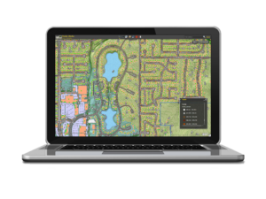 With GreenCityGIS, the Town of Windsor’s park staff has a Parks Viewer, Collector App, Operations Dashboard, Citizen Awareness applications, and Dynamic Database Integration. With the Parks Viewer users can view, interpret, analyze, and monitor park infrastructure with real-time maps, geo-analytics, and custom software widgets for planning and decision support. The Collector App is an easy-to-use, mobile Graphic User Interface (GUI) that works on tablets and smartphones, allowing staff to collect photos, videos, and infrastructure notes while working in the field. This application was used to complete a full park asset inventory.
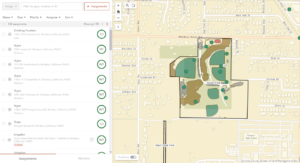
The final applications in the GreenCityGIS suite are built for Citizen Awareness. They provide Parks and Recreation Departments the opportunity to promote and showcase their programs and engage residents through public-facing web applications. Here, citizens have 24/7 access to information such as park hours, recreation schedules, and available amenities.
 Over the years, Town officials often discussed a solution to increase efficiencies in their work order system. They wanted a lightweight application that didn’t require a huge upfront investment and that wouldn’t incur recurring costs. They knew GIS offered a premium solution, but they needed to ensure they had the resources to support implementation. In the Spring of 2019, the Town received the approval they needed and contacted GTG to move forward.
The Workforce for ArcGIS application was a great match for The Town of Windsor because it was affordable and worked with the software and licensing they had already set up through Esri. Parks and Recreation staff were excited to take paperwork orders off the table and replace the system with innovative technology. It not only increased efficiencies, but it also saved their department time and money and increased the accuracy of collected data.
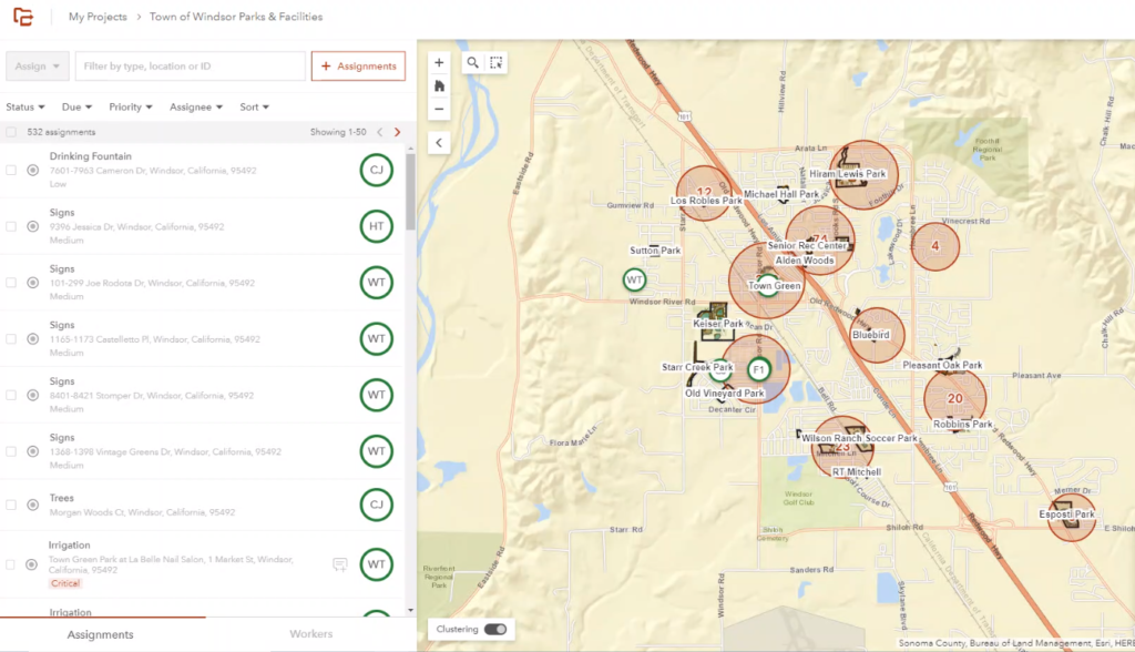
There are many benefits to utilizing Workforce in conjunction with the GreenCityGIS software suite and the Town’s existing programs. GTG used their parks’ data as a base map to create work orders on specific assets. This way, the work order is directly linked to a location. Field workers completing these tasks can launch the Collector App within the Workforce app to update photos and add notes about the condition of equipment, assets, and trees at the same time they are completing the work order. Mobile integrations give added flexibility and provide live asset inventory updates from tablets and mobile phones.
Further benefits include saving time, money, and eliminating manual processes that can become unorganized and tedious. The mobile GIS interface of Workforce negates any need for a paper trail, as all actions within the software are tracked back to the user. Operations and management staff can view outstanding work orders sorted by team, so work distribution is easily reviewed and adjusted as needed. This provides for the ideal allocation of resources, streamlined task management, and increased efficiencies for the Parks and Recreation Department.
As the Town of Windsor continues to utilize GIS for operations and support, they are looking at implementing further innovations and addressing any known limitations of the software. GTG works diligently to create custom solutions to department-specific needs and is excited to continue assisting the Town of Windsor Parks and Recreation team with GreenCityGIS and Workforce for ArcGIS software improvements.


