
LiDAR and 3D Smart Data Review
Irvine, CA
Throughout 2019 and 2020, the City of Irvine worked with Geographic Technologies Group (GTG) to create an Enterprise GIS Master Plan and Enterprise Data Management Plan. Every facet of the City's geospatial and data efforts were examined resulting in a step–by–step action plan for the next five years. The City has a very innovative GIS team with a strong desire to ensure that GIS aligns with City Council's overall vision and goals. Additionally, they are driven to become a center of geospatial excellence in the region.
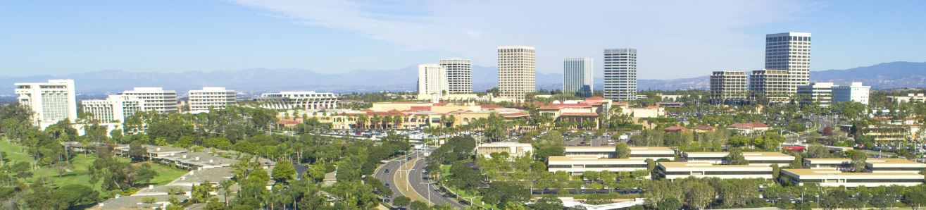
One of the showcases of the City of Irvine is the Orange County Great Park, a former Marine Corps Air Station (El Toro) that has been reimagined as a multi-purpose park. The park spans 1,300 acres and offers a diverse set of activities and recreation opportunities. As pointed out on the City of Irvine website, "Upon completion, the Orange County Great Park will join America's inventory of national treasures and set a new standard for great metropolitan parks around the world. Amenities already include the Great Park Balloon, the Carousel, the Great Park Visitors Center, Kids Rock play area, Walkable Historical Timeline, Historic Hangar 244, Palm Court, Farm + Food Lab, and the Great Park Sports Complex."
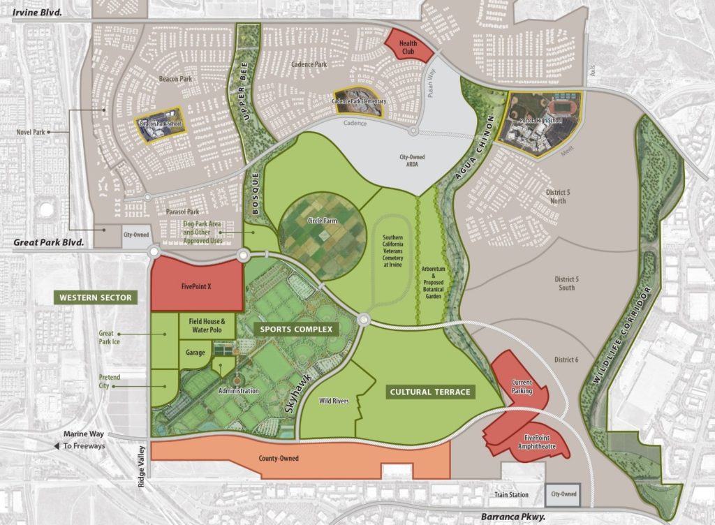
Orange County Great Park Overview Map
Such a diverse use of this space does not happen without significant planning. Geospatial technologies have played a large role in the planning and development of Great Park. High–resolution aerial photography and LiDAR data were obtained so that every facet of the park's topography and landscape could be visualized and understood, effectively optimizing development.
After the completion of the Master Plan, GTG was retained to assess the LiDAR data for usability. Jessy Beasly, GTG Senior GIS Analyst, points out, "We have extensive experience in the utilization of 3D data. The City needed to understand how this data could be used for park planning and visualization. Our team evaluated the data for quality and usability and to generate an estimate of time to process a terrain model." Metadata, LAS dataset statistics, and coverage of datasets were analyzed to ensure completeness and quality. The eventual outcome of the project was a report that identified the necessary steps to generate a high-resolution elevation surface and a 3-D model for use in a variety of planning projects for the park.
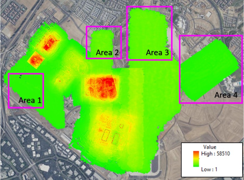
Analysis of spatial coverage and resolution of the LiDAR data
Jason Marshall, Director of GIS Consulting at GTG, points out, "Most of our clients have a vast wealth of data available to them but may not have the time or the internal technical skillsets to leverage the data for decision making. In this case, the City had invested in the acquisition of high-resolution geospatial data and was not using it to its fullest potential. Our team of data experts identified the steps necessary to integrate this data into the overall geospatial effort of the City and specifically Great Park."
————————-
For more information on data assessments or GIS strategic planning, contact Jason Marshall at jmarshall@geotg.com or 919.920.3071. You can also learn more about GTG and our services for Parks and Recreation at GreenCityGIS.com.


