

THE CITY OF BROKEN ARROW, OKLAHOMA
Located just South-East of Tulsa, The City of Broken Arrow has a population of over 99,000 residents and is the fourth-largest city in Oklahoma. With a large population to serve and protect, the City’s Police Department states that they strive to serve “… residents by proactively addressing crime, preserving the peace, protecting life and property, and by remaining committed to establishing partnerships within the community to focus on concerns and solve problems with fairness and in the best interest of all parties.” To meet these goals, they depend on innovative solutions and technology. One of these solutions is Geographic Information Systems, or GIS.
The City of Broken Arrow faces the same problem that every other city in the United States faces. That is, they have to make sense of the deluge of GIS/mapping applications available to them for public safety. With the GIS applications that come with their various Public Safety core applications (dispatch, records, mobile) and the wealth of GIS products from their GIS vendor (Esri), the City was facing a plethora of options. James Kelt, Public Safety Director for Geographic Technologies Group (GTG), states, “We have visited upwards of 500 public safety agencies nationwide. For most agencies, we see the same thing over and over – underutilized GIS.”
![]() Most agencies stop at the mapping applications provided as part of their 911 and records management systems. Often, these are woefully inadequate from a technology or implementation perspective. Curtis Hinton, President of GTG, suggests, “GIS for public safety should revolutionize an agency. The available tools are amazing and continue to improve weekly. The biggest hurdle is that any given agency has so many competing priorities. They usually don’t have time to streamline their GIS efforts and select the best tools. That is why GTG launched the SafeCityGIS suite.” SafeCityGIS is an ecosystem created to support public safety agencies of all types. At the core of SafeCity is creating a plan of how best to use the tools that are available to the agency. Mr. Hinton points out, “Agencies are amazed when they see what GIS can do for them and that many of the tools we recommend they already own. It is about making sure existing data is leveraged and available internally and to the public through the very best software available.”
Most agencies stop at the mapping applications provided as part of their 911 and records management systems. Often, these are woefully inadequate from a technology or implementation perspective. Curtis Hinton, President of GTG, suggests, “GIS for public safety should revolutionize an agency. The available tools are amazing and continue to improve weekly. The biggest hurdle is that any given agency has so many competing priorities. They usually don’t have time to streamline their GIS efforts and select the best tools. That is why GTG launched the SafeCityGIS suite.” SafeCityGIS is an ecosystem created to support public safety agencies of all types. At the core of SafeCity is creating a plan of how best to use the tools that are available to the agency. Mr. Hinton points out, “Agencies are amazed when they see what GIS can do for them and that many of the tools we recommend they already own. It is about making sure existing data is leveraged and available internally and to the public through the very best software available.”
Mr. Kelt recounts the Broken Arrow efforts, “Our first step was to help Broken Arrow normalize their data. They knew they wanted to map, view, analyze, and share key data elements but needed to clean up their databases (GIS and records).” Through the use of various analytical tools and automation tools, GTG assisted Broken Arrow in automatically geocoding all of its key datasets. Mr. Hinton points out, “One of the best things this project has accomplished is automating the GIS data creation process. Once key data enters Broken Arrow’s systems, it is mapped.” Many agencies struggle with this, often spending hours weekly in data cleanup efforts just to retrieve basic reports and maps.
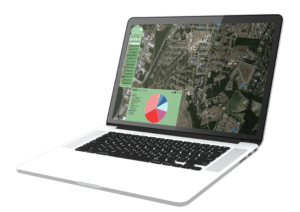 After the data processes were refined, Broken Arrow implemented Esri based dispatch, mobile, crime and fire incident analysis, and public-facing tools that are part of the SafeCityGIS suite. Broken Arrow staff noted that the tools are easy-to-use and intuitive, allowing them to quickly visualize and analyze key data. Additionally, the department implemented public-facing tools (MapNimbus) that are part of GTG’s SafeCityGIS Suite. The public can now view and receive notification about incidents in areas of interest in and around the city.
Broken Arrow is taking the next step with SafeCityGIS by implementing a full suite of Esri tools for Emergency Operations. Mr. Hinton points out, “GTG has worked with hundreds of agencies and has hand-picked the very best tools for emergency operations. We are teaming with the City of Broken Arrow to implement Esri tools for a Common Operational Picture, damage assessment, map-based executive dashboards, and innovative public outreach tools.” Broken Arrow is fully immersed in the SafeCityGIS Ecosystem. Ongoing training and certification portals are being released this year for their employees to stay current in their needed skillsets.
——
For more information call James Kelt at 903.738.2560, or Stephen Bradley at 918-451-8394. You can learn more about SafeCityGIS initiatives at www.SafeCityGIS.com or by reaching out via email to jkelt@geotg.com.


