

The Cities of Broken Arrow and Moore
Located just South-East of Tulsa, The City of Broken Arrow has a population of over 99,000 residents and is the fourth-largest city in Oklahoma. With a large population to serve and protect, the City’s Police Department states that they strive to serve “… residents by proactively addressing crime, preserving the peace, protecting life and property, and by remaining committed to establishing partnerships within the community to focus on concerns and solve problems with fairness and in the best interest of all parties.”
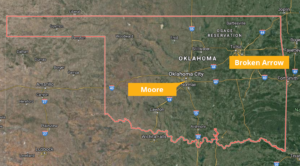
The City of Moore, Oklahoma lies just nine miles south of Oklahoma City and was incorporated in 1893, seven years after three railways laid tracks through the area. Through 1950, Moore remained a small town with a population of fewer than 1,000 people. But in the 1960s, the city became one of Oklahoma’s fastest-growing cities, and as of the 2010 census, the city boasts a population of 55,081. The City of Moore has a strong focus on community enrichment and amenities and features eight city parks, a community center, a library, a community pool, and several golf courses.
The Cities of Broken Arrow and Moore both maintain the Public Safety Answering Point (PSAP) for their area, and as a result, face similar challenges. One of those is ensuring that they are Next Generation 911 (NG911) compliant and also that they are using the optimal GIS tools for their agency. Both agencies turned to Geographic Technologies Group (GTG) to assist with the public safety mapping and NG911 preparation, as GTG was recently selected by the Oklahoma Office of Management and Enterprise Services (OMES) as a preferred vendor for Next Generation 911 (NG911) Data Creation Services.
James Kelt, Public Safety Director for GTG, states, “NG911 is multi-faceted. First and foremost, the data has to be complete and compliant with the new system. Gone are the cumbersome Master Street Address Guide (MSAG) tables. Now the technology relies on GIS for address location and validation. Having 100% complete and accurate GIS address points and street centerlines are mandatory for NG911 implementation.”
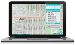 GTG has assisted agencies nationwide with NG911 data and is assisting the Cities of Broken Arrow and Moore in ensuring that their data is used optimally in the latest GIS/mapping tools. Mr. Kelt points out, “Our team of Public Safety experts provides NG911 data assessments, data creation, and data cleanup services. We also helped Broken Arrow and Moore implement the ideal set of GIS tools, which included dispatch mapping, executive dashboards, and analytics applications. Without good data, their NG911 compliant GIS applications would be of little value. We help clients first identify the gaps in their data, and then we work to close those gaps. At that point, they can implement and effectively use GIS to visualize and analyze public safety information.”
“I have been in this business for 23 years and I have NEVER worked with a more helpful vendor! GTG has been absolutely phenomenal when it comes to training, answering questions, and assisting us with whatever we need. I would — without hesitation — recommend this company to anyone. Hands down the best vendor I have ever worked with!” – Tammy Koehn, Communications Supervisor for the Moore Police Department
—-
GTG offers an informative online webinar or onsite presentation (whatever works best for you) detailing the “10 Ways to Improve Your Public Safety with GIS and Ensure Next Generation 911 Compliance.” If interested in this no-cost seminar, contact James Kelt at 903.738.2560 or jkelt@geotg.com. You can also learn more about NG911 services from GTG at SafeCityGIS.com/next-generation-911.


