IMPLEMENTING GREENCITYGIS
THE COLONY, TEXAS
The Recreation and Parks Department of The Colony, TX is focused on quality of life for their community. To that end, they maintain community parks, lake-side parks, trails, pavilions, golf courses, and a host of innovative recreation programs. Like most communities, The Colony has the challenge of managing their assets and educating the community about the wealth of parks and recreation opportunities in their area.
Curt Hinton, President of Geographic Technologies Group (GTG) states, “The common theme we see nationwide is that many cities have a fantastic park system but struggle to make residents and visitors aware of the resources available to them. Our team members travel worldwide and are voracious hikers, outdoorspeople, and park enthusiasts. We find that most cities do not have tools to promote their parks in an intuitive manner nor manage their assets effectively. So instead of complaining about the lack of information provided by Parks and Recreation Departments, we decided to help Parks and Recreation Departments implement an impactful suite of tools that geo-enable all of their assets/operations and inform the public.” The Colony had a shared vision with GTG of implementing a suite of tools for this purpose — GreenCityGIS.
The first task at hand, was to conduct a complete inventory of available parks and park assets. GTG worked closely with city staff to do a field inventory in the parks, resulting in detailed GIS layers of all assets, from fields and fences to park benches and lights. Once complete GreenCityGIS software was implemented to include the following applications (all Esri-based).
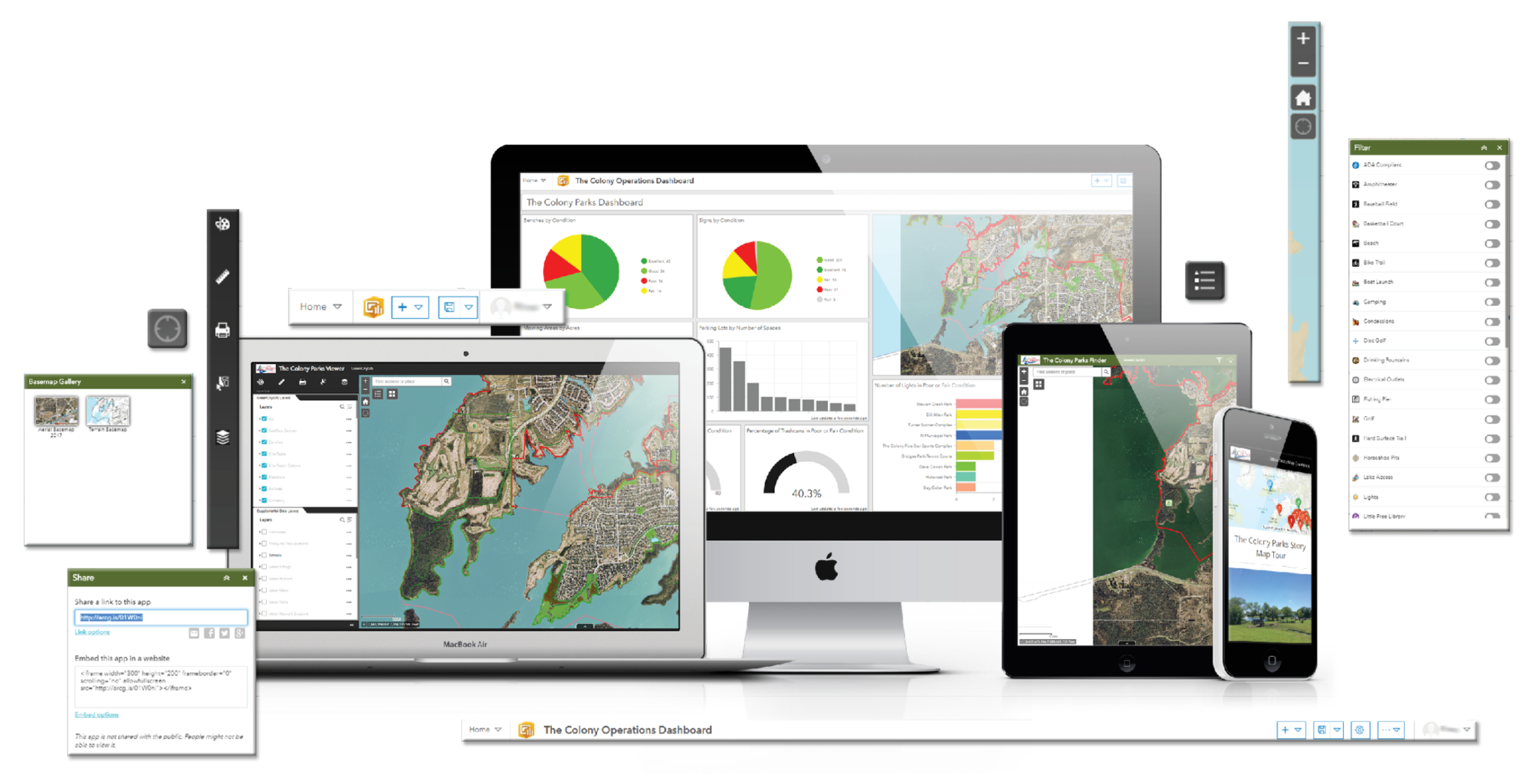
- Park Viewer — enables staff to visualize, analyze, and manage assets.
- Mobile Collector — enables field crews to make ongoing updates and collect new asset information while in the field.
- Operations Dashboard — enables decision makers with dynamic monitoring of activities and events (tracks field work and allows for monitoring performance measures).
- Story Map — public facing applications that are highly intuitive and tell the story of the parks in a graphic rich and information way.
- Parks Finder — enables the public to quickly find the optimal park, trail, and/or facility based on infrastructure, amenities, distance, desired activities, and any other qualifiers as set by the city.
Once these applications are fully implemented, The Colony expects to see better management of their park assets in terms of prioritizing maintenance and repairs. James Kelt, Client Evangelist based in the City of Longview, TX, states; “GreenCityGIS truly will serve to revolutionize how parks at The Colony are managed and perceived. It is exciting to provide a community with tools that improve their life and impact people in a positive way. We look forward to partnering with The Colony to continue to extend the suite and impact the community.”
For more information about GreenCityGIS and the custom software suite for Parks and Recreation Departments, visit GreenCityGIS.com or contact James Kelt by email, jkelt@geotg.com, or at 903.738.2560.