

ArcGIS Hub
Innovative Uses for Local Government
Esri’s ArcGIS Hub is a flexible platform that transforms the way you communicate and engage with your community. It is part of the Esri Geospatial Cloud and helps local government agencies organize people, data, and tools with information-driven initiatives. Geographic Technologies Group (GTG) is assisting cities, towns, and counties across the nation to configure custom ArcGIS Hubs, and it has prompted innovative uses of the technology.
ArcGIS Hub allows you to create unlimited websites to share your authoritative data with citizens and potential residents. You can organize these websites around your initiatives and build a portal that both informs and engages the public for increased transparency and better decision-making. Hubs may include charts, interactive maps, story maps, dashboards, links to local resources, and time-sensitive updates.
Here are just a few government agencies utilizing GIS Hubs for increased transparency and more efficient management.
Managing Pandemic Response Efforts with GIS – The Roswell, Georgia COVID-19 Project
The City of Roswell, GA has a long history with GIS and Geographic Technologies Group (GTG). In 2015, they contracted GTG for a GIS Strategic Plan, which led to the implementation of SafeCityGIS software and services. This contributed to them earning the title of “#18 Safest City in the United States” by City Crime Rankings. When the COVID-19 pandemic hit the United States, the City of Roswell was quick to reach out to GTG for support.
The collaboration process included the development of methods for data visualization, which is a staple of GIS. GTG and the City of Roswell implemented, configured, and introduced various Esri solutions — including Dashboards, Story Maps, and the Community Analyst solution — within the framework of an ArcGIS Hub.
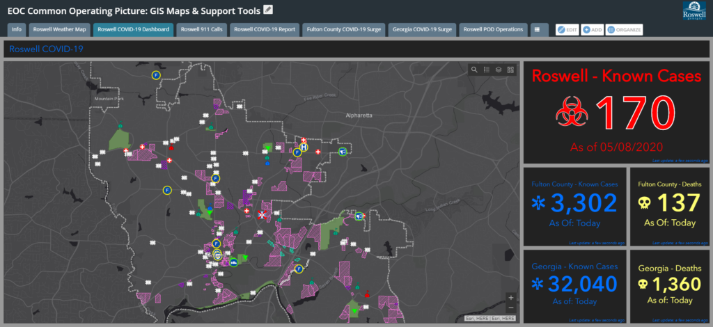
An internal dashboard provided information and tracking on known affected areas and the number of cases within the City of Roswell, Fulton County, and the State of Georgia. The second Dashboard was also for internal use and tracked call counts and trends for the City of Roswell 911 calls. Further applications included the Community Analyst solution and the Roswell Weather Events Web AppBuilder. Esri’s Community Analyst created a critical demographic report for COVID-19 susceptible areas and populations.
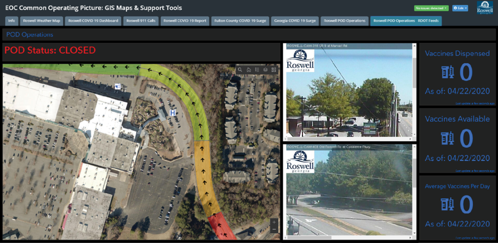
Taking their response one step further, the City of Roswell is preparing for the future arrival of a vaccine with a Point of Distribution (POD) Operations dashboard on its Hub. This application tracks the number of available vaccines, how many vaccines are dispensed, and the average number of vaccines administered per day. It also features live traffic cams to monitor points of potential congestion sites around the location where the vaccine is planned to be administered to the public.
Since the implementation of ArcGIS Hub and advanced GIS tools, the City of Roswell has gained an increased awareness in COVID-19 response efforts. The EOC Common Operating Picture is a program that will continue to grow, expand, and evolve in Roswell.
ArcGIS HUB and Departmental Business Applications for The City of Hobart
The City of Hobart, Indiana is one of the county’s oldest communities. With a population of just over 29,000, Hobart provides a close-knit community on the banks of Lake George. As Hobart grew from a small town to bustling city, the Sanitary and Stormwater District realized the value of Smart City technology to maintain operations and quality of life for their community and its residents.
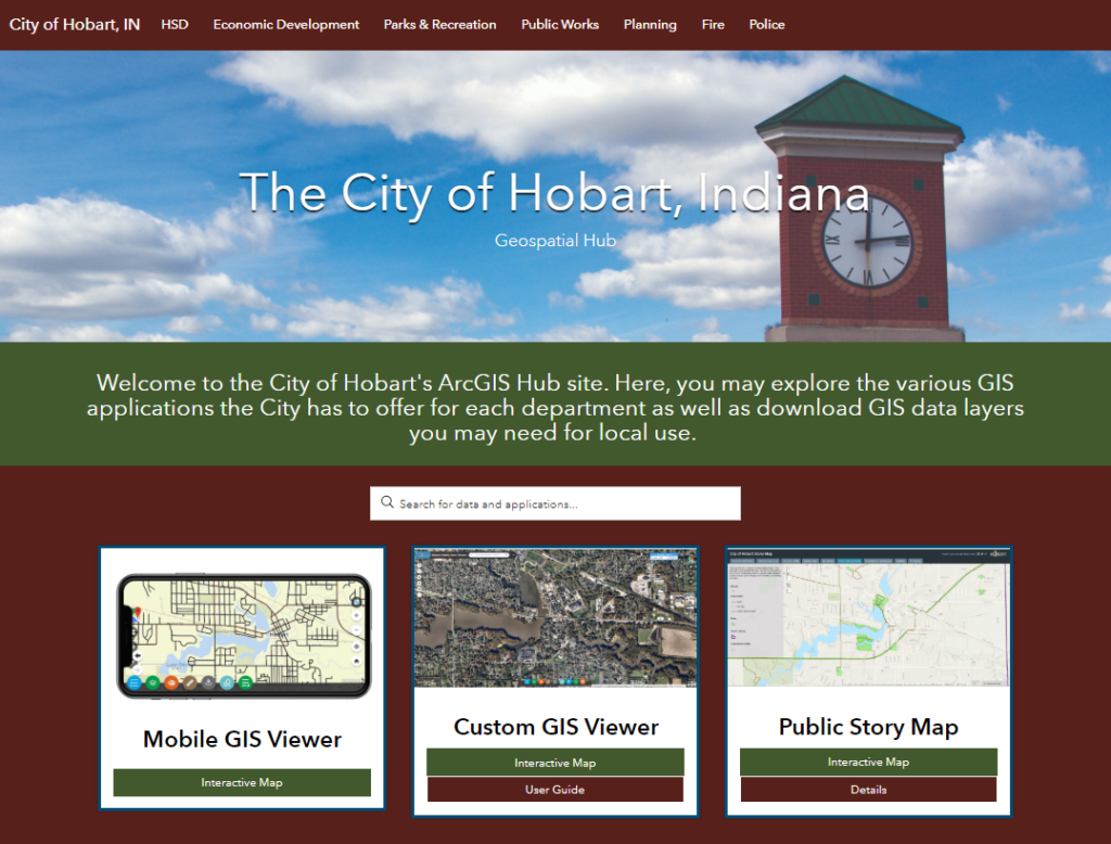 In early 2019, The City of Hobart Sanitary and Stormwater District reached out to Geographic Technologies Group (GTG) to write and implement a GIS strategic plan. A key piece of the City of Hobart’s GIS strategy was the creation of an ArcGIS Hub. This Hub is an informational web page that is fully customizable. It includes links to all available GIS applications as well as any additional departmental information the city would like to include to create a centralized data gateway – a GIS Hub. The main page serves city-wide initiatives with the primary GIS Viewer, and then there are sub-pages for each department, including the Sanitary and Stormwater District, Planning and Development, Police, Fire, Parks and Recreation, Economic Development, and any other departments that utilize GIS.
The Hub can be added to as the City’s GIS grows. The intent is that GTG will continue to develop solutions and applications and then will place them on each department-specific page as internal tools for each team. When someone needs to view their department’s applications, they simply go to their sub-page and access all the direct links to available data and interfaces. The Hub also increases transparency and communication between teams, as each department can view other departmental sub-pages and the linked applications.
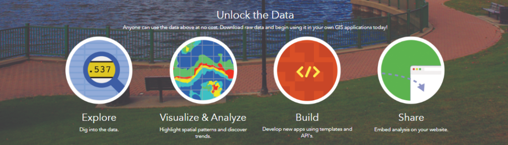
The City of Hobart also utilizes the Hub as an open data portal. When you visit the website, you can download any GIS files the city has identified as “open data.” For example, a citizen may choose to retrieve city park shapefiles for a school project or report.
With all these tools in place and their quickly growing GIS infrastructure, the City of Hobart is well on its way to creating a thriving Smart City.
SafeCityGIS at Work for the City of Simi Valley’s Emergency Operations Team
The City of Simi Valley is located in southern California halfway between Santa Barbara and Los Angeles. With a population of 126,878 (as of July 1, 2017), Simi Valley is Ventura County’s third-largest city. Sitting near two fault lines – one of which is the major San Andreas Fault – and with summer heat spurring on wildfires, Simi Valley is especially vulnerable to natural disasters. In May 2018, their Emergency Operations Center (EOC) reached out to Geographic Technologies Group (GTG) for support.
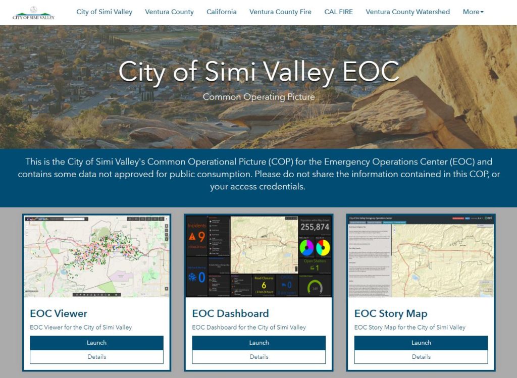
The primary reason The City of Simi Valley came to GTG was that they needed a comprehensive GIS suite to interpret data used before, during, and after any disaster event. They needed to visualize incident locations and details in a map-based representation to increase planning and response accuracy and efficiencies. This system was to be utilized to its full extent as a foundation for decision-making and strategic planning regarding the development and management of the daily operations of the City’s EOC.
The City of Simi Valley was already deploying various Geographic Information Systems (GIS) initiatives for projects and departments throughout the city, but prior to this project with GTG, the EOC team did not have a focused implementation of GIS data, software, technology or the training. After consulting with the EOC team at The City of Simi Valley, GTG proposed the deployment of software solutions within the framework of an ArcGIS Hub to create a Common Operating Picture.
After all pertinent data was created and/or integrated with applications on the City’s Hub, the EOC saw tremendous value in having all information easily viewed and analyzed within the “one-stop-shop” of the Hub interface. Applications include an EOC Viewer, EOC Dashboard, and EOC Story Map.
- EOC Viewer – Displays incident reports and data on an interactive map, and contains numerous widgets for quick, dynamic analysis.
- EOC Dashboard – A statistically-driven and geo-enabled solution for supervisors and managers to monitor ongoing efforts, resources, opportunities, and threats.
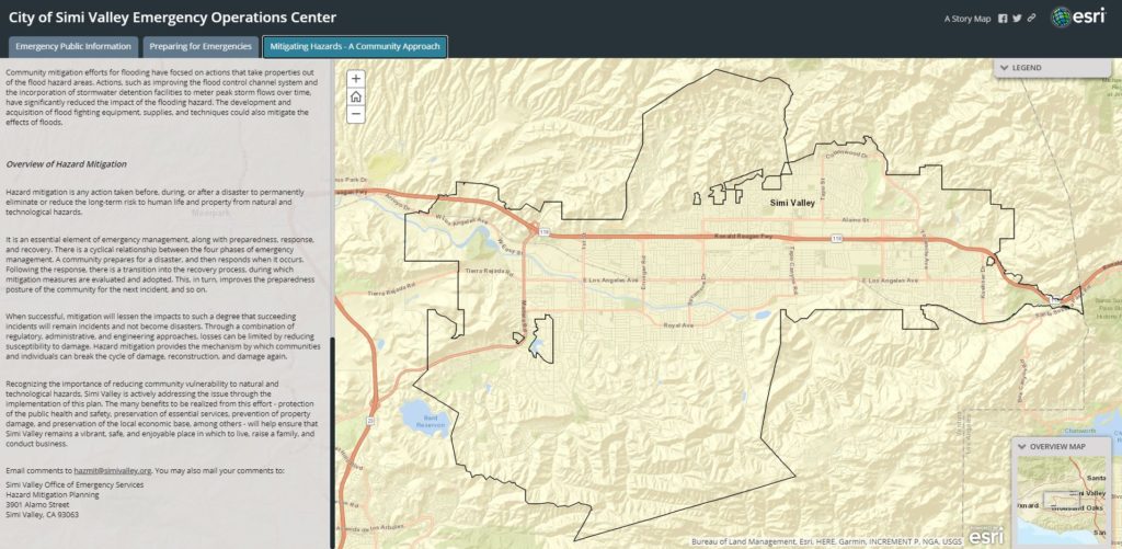
- EOC Story – Allows for the inclusion of detailed text to showcase current emergency operation initiatives, share emergency preparedness information, and list links to additional resources.
SafeCityGIS is an innovative enterprise and sustainable GIS management and analysis system and is changing and shaping the way that Emergency Operation Centers function, operate, and think about data. The system utilizes Esri’s foundation of new software products and provides a knowledge-based solution that delivers state-of-the-art geographic software, analysis, and visualization for situational awareness in real-time. ArcGIS Hub with GTG’s SafeCityGIS is an irreplaceable turnkey solution that offers a host of benefits to the City of Simi Valley EOC, decision-makers, field collection personnel, citizens, and more.
ArcGIS Hub Deployment
ArcGIS Hub perfectly fits the open data/open government model and provides a scalable central repository for users outside the City to access, interact with, and download select organizational data. GTG recommends that the City leverage the capabilities of ArcGIS Hub to increase citizen engagement, collaborate with the community, and provide a means for third parties to acquire necessary data in a digital, one-stop environment.
When you work with GTG for ArcGIS Hub deployment, GTG will develop an ArcGIS Hub that meets your internal and public needs of your organization to provide a modern and user-friendly data and web GIS sharing experience. The development of a Hub will be accompanied by a consulting meeting with project stakeholders to review and document the required ArcGIS Hub design, structure, content, and shared data. GTG will then build the internal and public ArcGIS Hub sites to these documented specifications.
A key building block of effective and sustainable GIS is training, education, and knowledge transfer for government staff. To ensure the most efficient use of your new Hub, GTG will provide an SOP on the use and administration of the ArcGIS Hub applications along with a training webinar to demonstrate the use of the applications and the administration of the Hub platform. Our team is available to support your staff and the use of GIS applications from project initiation to completion.
To learn more about ArcGIS Hub and the many GIS applications available for local government, please reach out to James Kelt at jkelt@geotg.com or 903.738.2560.
—
To view this case study in flipbook form, click here.


