
Background
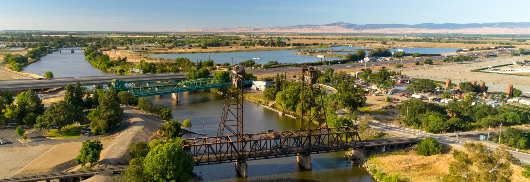
The City of Lathrop, California is in the Northern San Joaquin Valley. It straddles the San Joaquin River at the crossroads of three major highways. The 31-year-old city has a diverse constituency of over 26,000 people with a higher population density than most of California. The city has made headlines as one of Northern California’s fastest-growing communities, due to the 5.6% change in growth from 2019 to 2020.
The City of Lathrop maintains a relatively lean Geographic Information System (GIS). The City’s GIS has a relatively small GIS footprint, both in terms of their technological infrastructure and the availability of GIS resources. Like many cities, Lathrop relies on Esri’s ArcGIS platform as its primary GIS software,
utilizing both desktop and enterprise applications. The City relies on its GIS to support custom web applications, to maintain the authoritative source of spatial records, and to generate static maps and GIS deliverables to better serve their internal and external customers.

The City of Lathrop was interested in developing a practical understanding of its GIS to improve geospatial operations, to more completely leverage the capabilities of their GIS, and to realize the potential of their GIS. In the Fall of 2019, the City of Lathrop engaged Geographic Technologies Group (GTG) to assess the existing GIS and make recommendations on modernizing and upgrading the current system. This assessment, along with GTG’s expertise and knowledge of GIS and IT industry best practices, resulted in a set of recommendations for the City aimed at improving performance and modernizing their GIS.
This assessment also included an implementation action plan to guide the implementation of a modern, performant, and sustainable enterprise GIS, designed to meet the current and future needs of the City.
Project Overview
The City of Lathrop relies on its GIS to support its business operations and to make data-driven decisions. As the City adapts and matures its operations, the need for a modern, high-performance and dynamic enterprise GIS is paramount.
Advances in technology, coupled with a growing expectation of web-accessible and dynamic geospatial content, have created the need for a more robust, flexible, and performant GIS. GTG made multiple recommendations designed to meet GIS and Information Technology (IT) best practices, modernize their GIS, and provide exceptional geospatial services to both the City’s staff and its residents. Those recommendations centered on five foundational activities aimed at reimagining and improving geospatial operations at the City: 
- Implement a distributed Web GIS using Esri’s ArcGIS Enterprise platform;
- Design a compact, multi-tiered, service-oriented architecture (SOA) GIS that employed workload separation and unified system administration;
- Consolidate the City’s geodata footprint into a central data repository;
- Update the GIS’s web application suite; and
- Refactor and improve the City’s existing automated parcel management scripts.
GTG scaffolded a strategic roadmap for realizing the above objectives. This roadmap outlined the steps required for the City to achieve GIS modernization through a realistic, stable, and effective manner. GTG then provided consulting services to design and implement the City’s ArcGIS Enterprise architecture and migrate the City’s web GIS services and content to the new system. Finally, GTG developed an Export, Transform, Load (ETL) script to automate GIS parcel data updates in the Lathrop GIS with data from the San Joaquin County Assessor’s Office.
ArcGIS Implementation
Given the prominence of the ArcGIS platform and the comprehensive suite of GIS applications and solutions provided by Esri, the City made the decision to leverage Esri’s ArcGIS Enterprise platform as their web GIS framework. The City engaged GTG to design and implement ArcGIS Enterprise, a unifying GIS technology that links the desktop GIS and web GIS ecosystems and enables the organization to share geospatial and tabular data, methods, and content efficiently and securely over the internet.
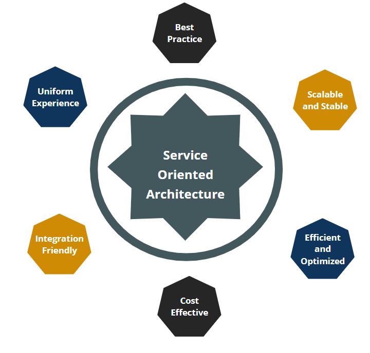 GTG recommended that the City fully leverage and rely on the service-oriented architecture (SOA) in its GIS operations. An SOA centralizes resources and content to improve the system’s performance and capacity while also positioning the City’s GIS portfolio to grow, adapt to changing business drivers, and easily integrate with other business systems. The infrastructure configuration was a coordinated effort between GTG, Lathrop GIS staff, and Lathrop IT staff. The implementation of the ArcGIS Enterprise system leverages the benefits of SOA and the spatial methods of Esri’s technology to provide a uniform, scalable, and performant mechanism to work with geospatial data and methods. To further improve overall performance and increase GIS scalability and flexibility, GTG designed and built a multi-tiered architecture system for the City’s GIS consisting of isolated web, application, and database tiers.
To fulfill the best practice of environment isolation, GTG setup both production and non-production (development) environments in the enterprise GIS system to increase system stability and allow staff to interact with the system without affecting critical business processes. The development environment functionally mirrors the production environment, giving the City a place to test new services, develop new solutions, evaluate upgrades, and safely implement change control procedures.
Together, the implementation of ArcGIS Enterprise incorporating SOA, multi-tiered architecture, and production and non-production environments result in a robust, stable foundation that modernizes the City’s GIS, enabling more return on investment with greater opportunities to provide geospatial solutions.
Web GIS Migration
The City of Lathrop leverages both cloud-based ArcGIS Online (AGOL) and on-premise ArcGIS Enterprise resources for serving its web maps and applications. The City has six (6) custom applications deployed on a web server that has been built using Esri’s Web AppBuilder (Developer Edition). The suite of Web Applications is designed to provide City staff with centralized endpoints for geospatial data discovery, analysis, and reporting, and allow for city stakeholders to generate mailing lists and citizen reports.
In this phase of the project, GTG updated the organization’s current applications using Web AppBuilder (Developer Edition v. 2.1.3) software. The new applications were released simultaneously with the Enterprise GIS rollout. Updating the apps to the latest platform allows the City to maintain them going forward.
County Parcel Automation Script
Like many municipalities, information related to parcels is managed by multiple stakeholders. For the City of Lathrop, this responsibility is split between the San Joaquin County Assessor’s Office and the City’s internal parcel management team. In order to leverage the information managed by both parties, GTG developed and implemented an automated ETL script to automatically merge these datasets monthly when updated data is delivered to the City. The script updates the City’s Parcel GIS Layer with the updated data, which is then immediately available to all Desktop GIS and web GIS users. This enables users throughout the City to find parcels and property owners from within the GIS apps, thereby reducing the need to search through multiple sources to locate this information.
Summary
The City of Lathrop requires a GIS that will work for them now and into the future. The advances made in technology, the realization of a truly enterprise-ready GIS platform, and the changing demands of the community, has led to the implementation of a sustainable enterprise GIS. GTG consultants reviewed the City’s existing GIS and, with their unique and deep knowledge of enterprise GIS, designed a GIS that is both highly functional and sustainable. GTG’s design balances the competing interests of industry best-practices with organizational constraints and capacities and increases the City’s ability to manage, analyze, and share geospatial insights. These insights lead to a more informed decision-making process for City stakeholders, a more informed community, a higher return on investment, and a secure and stable GIS.
—————–
To learn more about ArcGIS Implementation and GIS Services from Geographic Technologies Group, please feel free to reach out. You can speak to our team by calling 888.757.4222 or emailing moreinfo@geotg.com.


