
Interns and staff create GIS-enabled mobile app for Bald Head Association
BALD HEAD ISLAND, NC
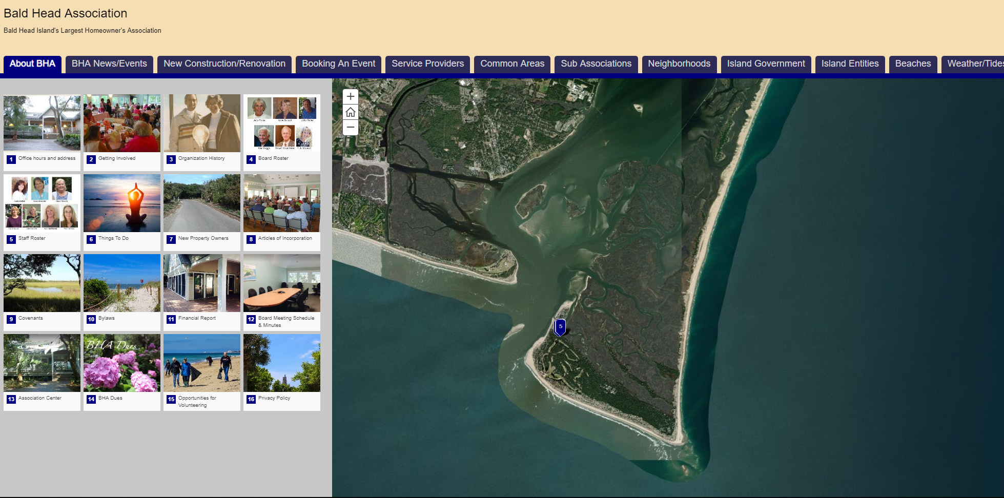
Planning a visit to Bald Head Island in North Carolina (NC)? Find out everything there is to know, do and see with the BHA Mobile App, an interactive mapping application created by the Bald Head Association (BHA) and a pair of Liberty University students participating in a summer internship opportunity provided by Geographic Technologies Group.
In 2017, Bald Head’s largest homeowner’s association, BHA, sought help in creating a mobile-compatible public-facing web map that leveraged the power of geographic information system (GIS) technologies to provide residents, property owner’s and visitors with essential information about the community and the environment.
Situated at the tip of Cape Fear in southeastern NC, Bald Head is a remote barrier island rich in historical interest and natural beauty.
Help was close by for BHA, as just a few hours to the northwest, the GIS consulting and software development specialists at GTG were looking for the perfect project for two summer interns they had hired. With GTG’s experts there to oversee their efforts, the project would be a valuable learning experience for the two students and provide some cost-savings to the association.
The interns worked with BHA to create the GIS-enabled web map throughout the summer of 2017. The application—powered by Esri’s Story Maps for ArcGIS—highlights the island’s history, features and attractions, as well as community initiatives, mandates and events.
Following two months of research and development, plus a trip to the island to capture imagery, the two interns and participating staff members unveiled their work to BHA.
The application details an array of recreational opportunities ranging peaceful to thrilling. Users looking for a more mellow kind of fun can locate one of the island’s walking trails or get directions to the 18-hole golf course.
Users seeking a bit more action can find one of Bald Head’s surfboard, paddle board or kayak rental shops, and then locate one of the many beach access points to launch their preferred craft.
All of the island’s restaurants and retail stores are described in full with pictures, contact information, driving directions and more. The application also provides detailed emergency information displayed — like everything else — over high quality satellite imagery.
The BHA Mobile App is available for mobile download or desktop use now at www.BHAmobile.com.


