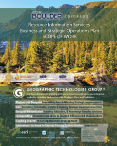
GIS Strategic Planning for High Performance Organizations (HPO)
The City of Boulder Colorado, Open Space and Mountain Parks (OSMP)
Few municipal resources are as valuable as natural ones, and effectively managing them for use and enjoyment by visitors — now and in the future — is critical. The City of Boulder, CO Open Space and Mountain Parks (OSMP) department is responsible for preserving and protecting the natural environment and land resources that characterize the Boulder area. The 45,000 acres of protected and preserved open space lands teem with native plants and wildlife and are home to threatened and endangered species. They serve as a buffer between Boulder and nearby development. They sustain agriculture uses and add untold benefits to the natural environment — clean air, water, and earth. The lands shape the urban mosaic of the Boulder Valley and provide citizens with recreation opportunities. Trails are used by walkers, hikers, bicyclists, horseback riders, dog walkers and other recreational users. Additionally, it fosters appreciation and uses that sustain the natural values of the land for current and future generations.

GIS Strategic Operations Plan (SOP)
Geographic Technologies Group (GTG) is excited to have helped with that mission by working with the OSMP Resource Information Services (RIS) Workgroup to complete a GIS Strategic Operations Plan (SOP). The project involved a comprehensive and detailed review of the RIS Workgroup workflows, standards, and procedures, as well as proposed improvements to many existing areas.
“GTG has raised the bar for strategic operation planning at the City. The process GTG used to create our IT/GIS SOP has become the gold standard for all future city strategic operations plans.” – Mo Valenta, Resource Information Supervisor for Boulder, CO
Collaboration and Consensus
Based on the collaborative findings and consensuses derived from the numerous fact-finding procedures, GTG and RIS were able to determine specific gaps and areas for improvement within the RIS Workgroup. GTG processed these findings and developed a Business and Strategic Operations Plan that defined prioritized recommendations and steps for transitioning gaps into opportunities. The RIS Workgroup is now in the process of implementing their revised roadmap for future success and is quickly evolving into a service-oriented workgroup that can focus on their envisioned purpose.
Two distinct phases involved in planning, designing, and developing the RIS Business and Strategic Operations Plan included the RIS Needs Assessment and the creation of the RIS Business & Strategic Operations Plan.
GIS Needs Assessment
GTG performed a detailed needs assessment of RIS-OSMP to evaluate existing workflows and provide a clear understanding of the outcomes needed, wanted, and expected of RIS. The assessment examined vision and values development, analysis of existing capacity, services and products provided, data accuracy and quality, databases, websites, software, mobile data collection, staff resources and organization, the existing geospatial data, workflows, operations, procedures, GIS integration, data gaps, training and education, IT infrastructure, city vision and policies, and current and future business requirements.
With these areas of improvement identified, GTG moved into the creation of the final product for the City of Boulder OSMP.
Business and Strategic Operations Plan
GTG produced a Business and Strategic Operations Plan that described a strategic, sustainable, scalable, and enduring enterprise system based on the specific needs, priorities, and constraints of OSMP. GTG developed design options, reviewed them with OSMP, and made final recommendations. The alternative system designs meet all the operational needs of OSMP in terms of high performance, effectiveness, sustainability, and economics.
The work that GTG has contributed to the OSMP and RIS Workgroup through the Needs Assessment and Business and Strategic Operations Plan will provide a clear and common path forward. As a result, the RIS Workgroup is truly moving toward their goal of being a service-oriented body charged with enabling and empowering all OSMP stakeholders and the eleven additional OSMP workgroups.
For more information about GIS Strategic Planning services and the full suite of Parks and Recreation tools offered with GreenCityGIS and Geographic Technologies Group, please contact James Kelt at 888.757.4222 or by email to jkelt@geotg.com. You can also learn more about GreenCityGIS services by visiting GreenCityGIS.com.


