Introduction
Nestled in the Rocky Mountains at approximately 8,200 feet above sea level, the Town of Snowmass Village is comprised of a medium density, mixed used, and transit-oriented core surrounded by suburban residential neighborhoods and open space. Over 35 miles of maintained hiking and biking trails and 150 miles of ski trails contribute to the 25 square miles that define the Town of Snowmass Village. Encompassed by a spectacularly scenic wilderness area and National Forest, the Town of Snowmass Village is one of many resort communities in the U.S. to offer plentiful on-mountain winter and summer activities; including lift-serve mountain bike trails, the second largest ski mountain in Colorado (most vertical feet of terrain in the U.S.), and one of the best summer resort music scenes in the state. It’s no coincidence that part of the town’s name is synonymous with “magnitude” and “substance.”
Project Details
When Snowmass selected Geographic Technologies Group (GTG) in late 2015 to complete a GIS Strategic Plan, the state of GIS within the town was not unlike many local governments throughout the country. These unfortunate, but all too common, parallels included the presence of GIS data silos constructed within departments; limited organizational access to critical data; and outdated methods for viewing, creating, and distributing GIS data. While isolated GIS practices were certainly evident throughout the town and its departments, a standardized, cooperative, and efficient GIS initiative was not. The mutual recognition of these facts formed the partnership between the Town of Snowmass Village and GTG, and provided the basis for an amazing GIS transformation and enterprise within the town.
Internal and External GIS Viewers
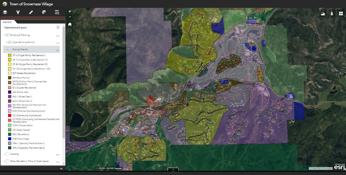
Fully deployed and interactive Internal and External GIS Viewers are at the forefront of the GIS movement for the Town of Snowmass Village. The GIS viewers are multiplicatively increasing the number of GIS users throughout the town. These browser-based, user-friendly GIS Viewers have given staff the means to be more efficient, collaborative, and engaged. Grouped by department, the Internal Viewer displays data layers that internal staff were previously searching for on a regular basis. Built-in widgets, or tools, directly give staff the ability to perform analyses and queries with just a few clicks. Furthermore, full integration with the town’s document management system, Laserfiche, has greatly reduced reliance on paper documents and staff time spent searching through file cabinets. Building and planning files, including plats, floor plans, and assessor information, can now be viewed in a matter of seconds via direct link from the parcels layer.
Additionally, themed External GIS Viewers including Building and Planning, Bus Stops and Routes, and Parks have been deployed for the public side of the spectrum. These public-facing GIS Viewers can be accessed through direct links from the town’s website and contain redacted versions of the Town’s GIS data appropriate for public consumption. These easy-to-use GIS Viewers put data, and more importantly answers to frequently asked questions, directly in the hands of citizens and improved citizen engagement.

Mobile GIS
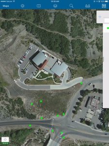
Enhancing the mobility of GIS throughout the organization was also a primary goal for the town’s revamped GIS initiative. In doing so, a desire for efficiency through simplicity was expressed. Historically, viewing and editing GIS data in the field had been complicated, cumbersome, and restricted to staff with backgrounds in GIS. However, The deployment of ArcGIS Online for the town, coupled with Esri’s Collector Application, quickly eliminated those bitter memories. Now, through these modern GIS implementations, town staff and field crews can quickly and easily update GIS data in real-time with the use of tablets and smartphones. Furthermore, data administrators can view ongoing changes and progress from field crews using the Collector Application in a live environment from the office.

Migration to Esri’s Local Government Information Model (LGIM)
One of the major keys to a successful GIS program is ensuring users have access to pertinent GIS data while mitigating instances of data duplication and inconsistency. Esri’s LGIM, which was created for local governments, provided the standardized central data repository the town needed to break down its existing data silos. The critical transition to this environment has allowed GIS users from all departments to have access to data that is now housed in one location eliminating the aimless, and often fruitless, search for data.


